Project Type
Urban Planning + Design
Project Location
Chicago, Illinois
Project Year
Master of Architecture, School of the Art Institute of Chicago - 2023, Thesis
Thesis Advisors
Monika Thadhani & Charles
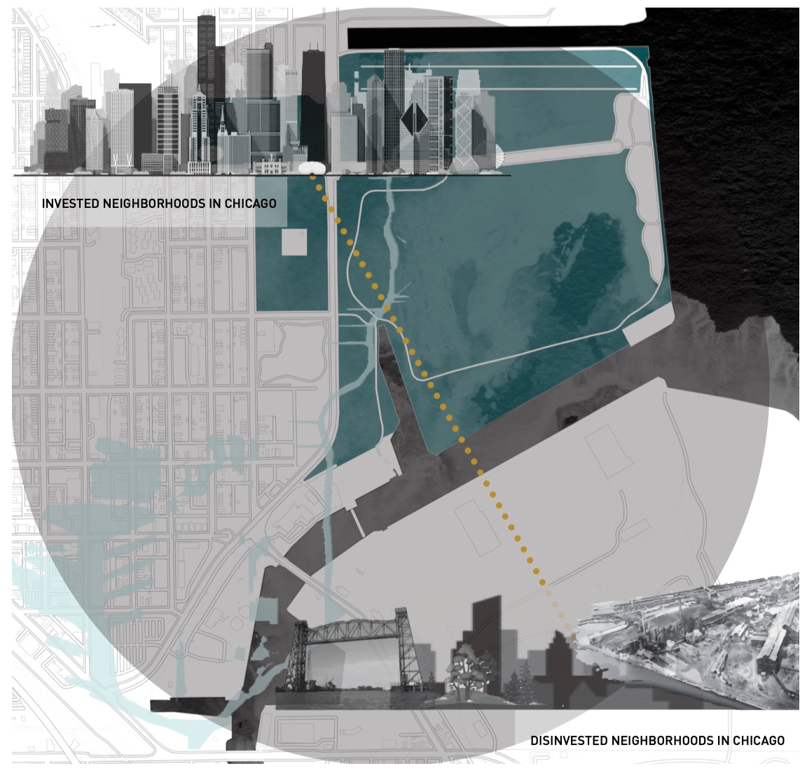
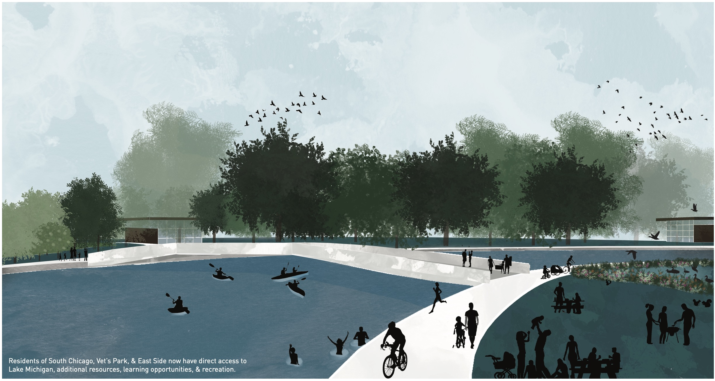
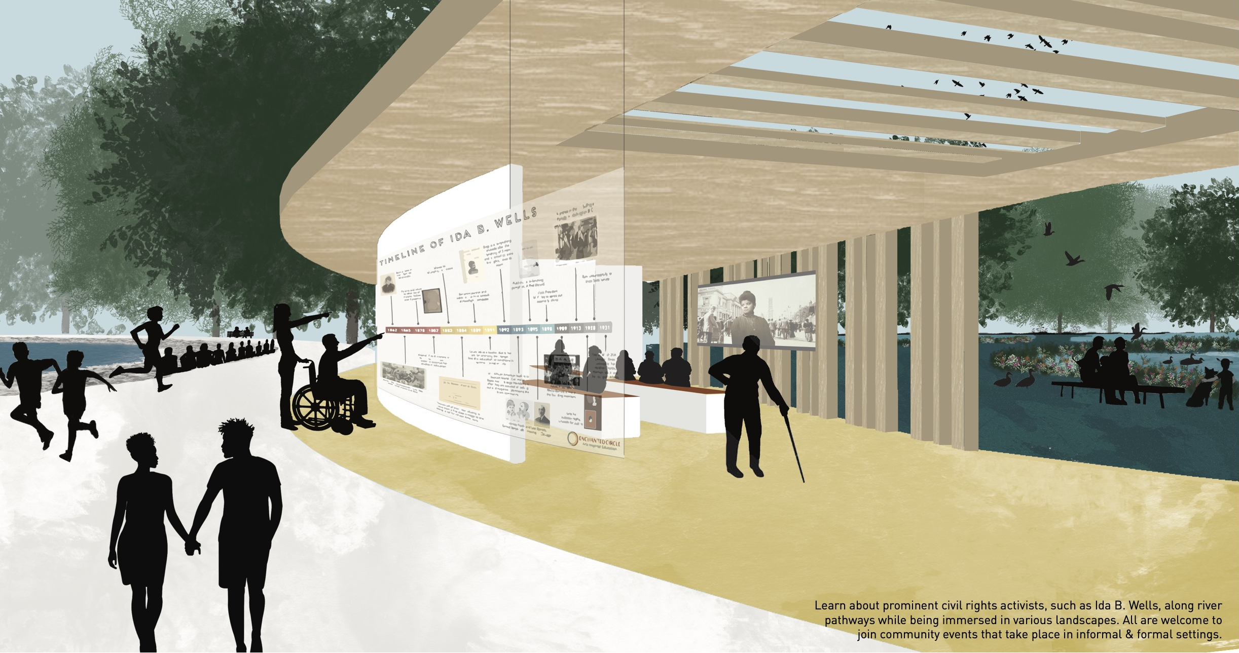
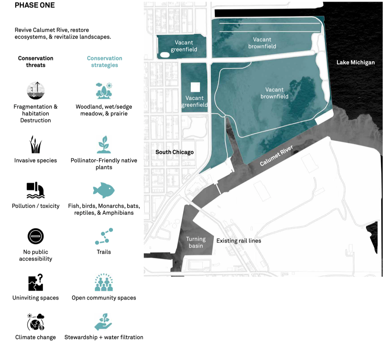
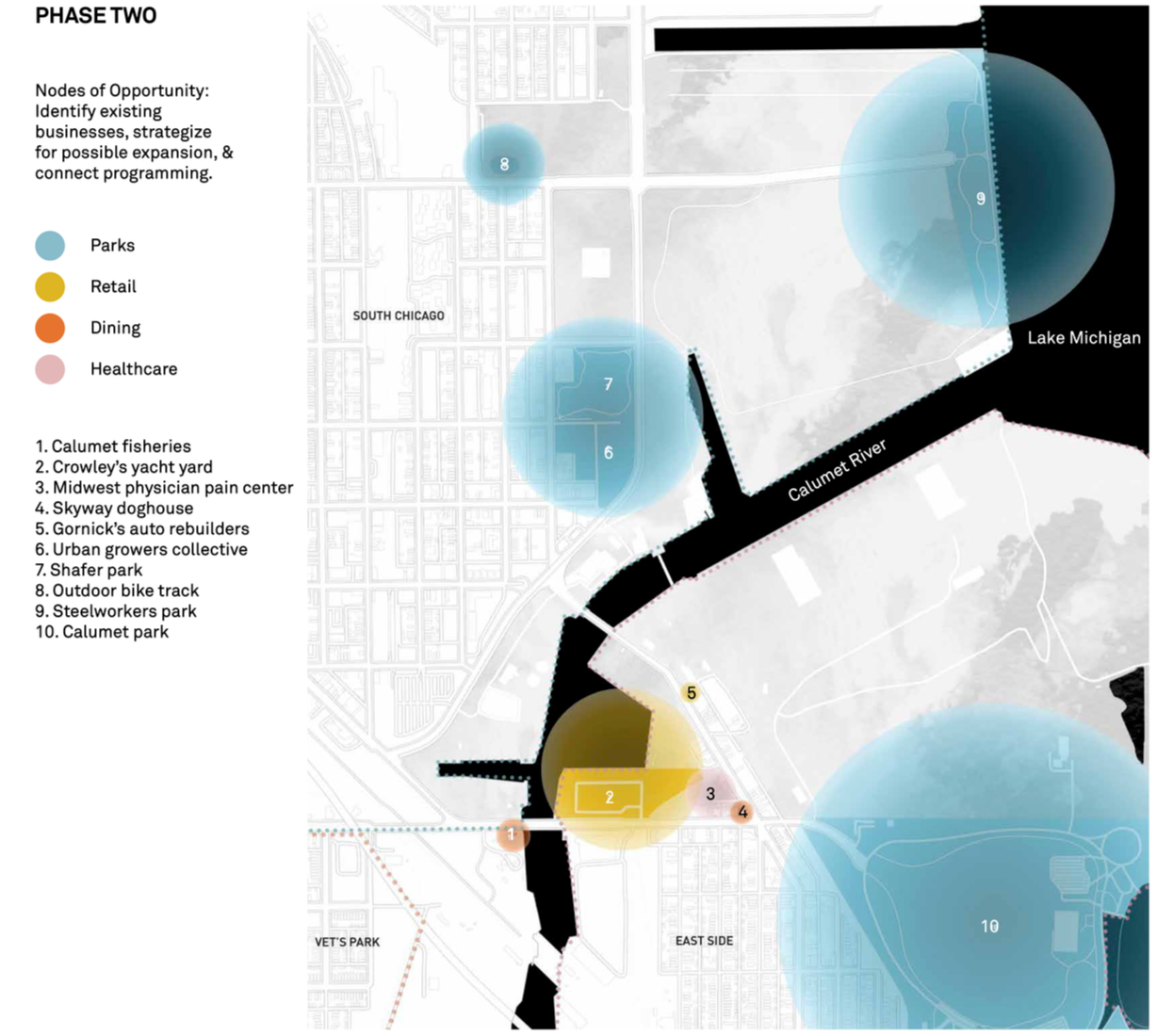
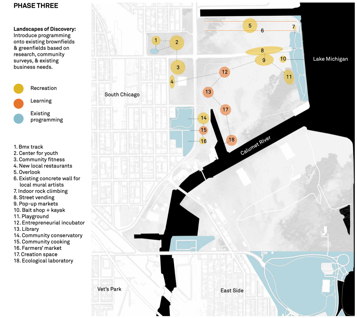
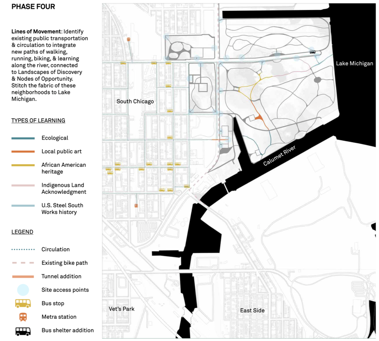
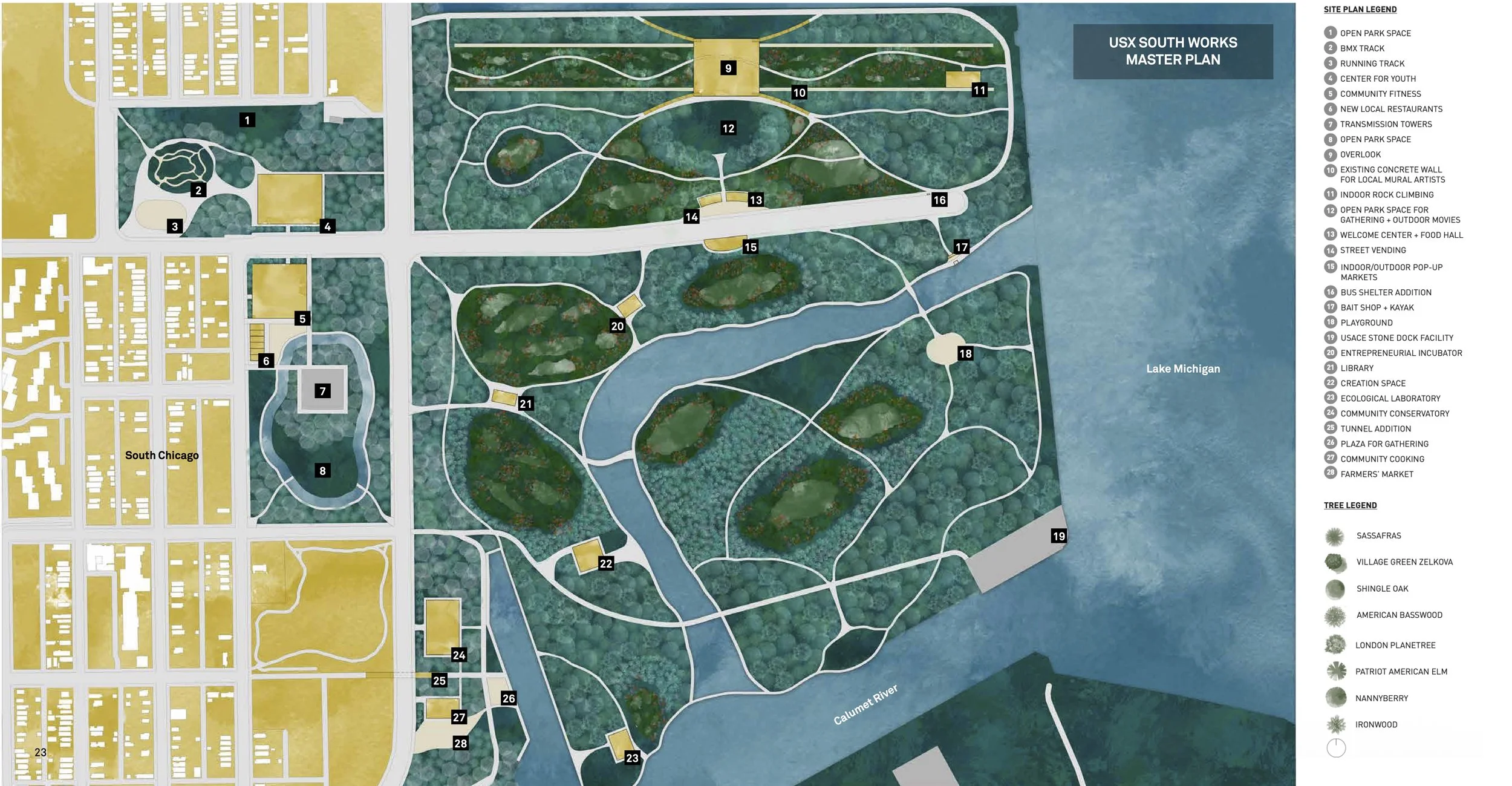
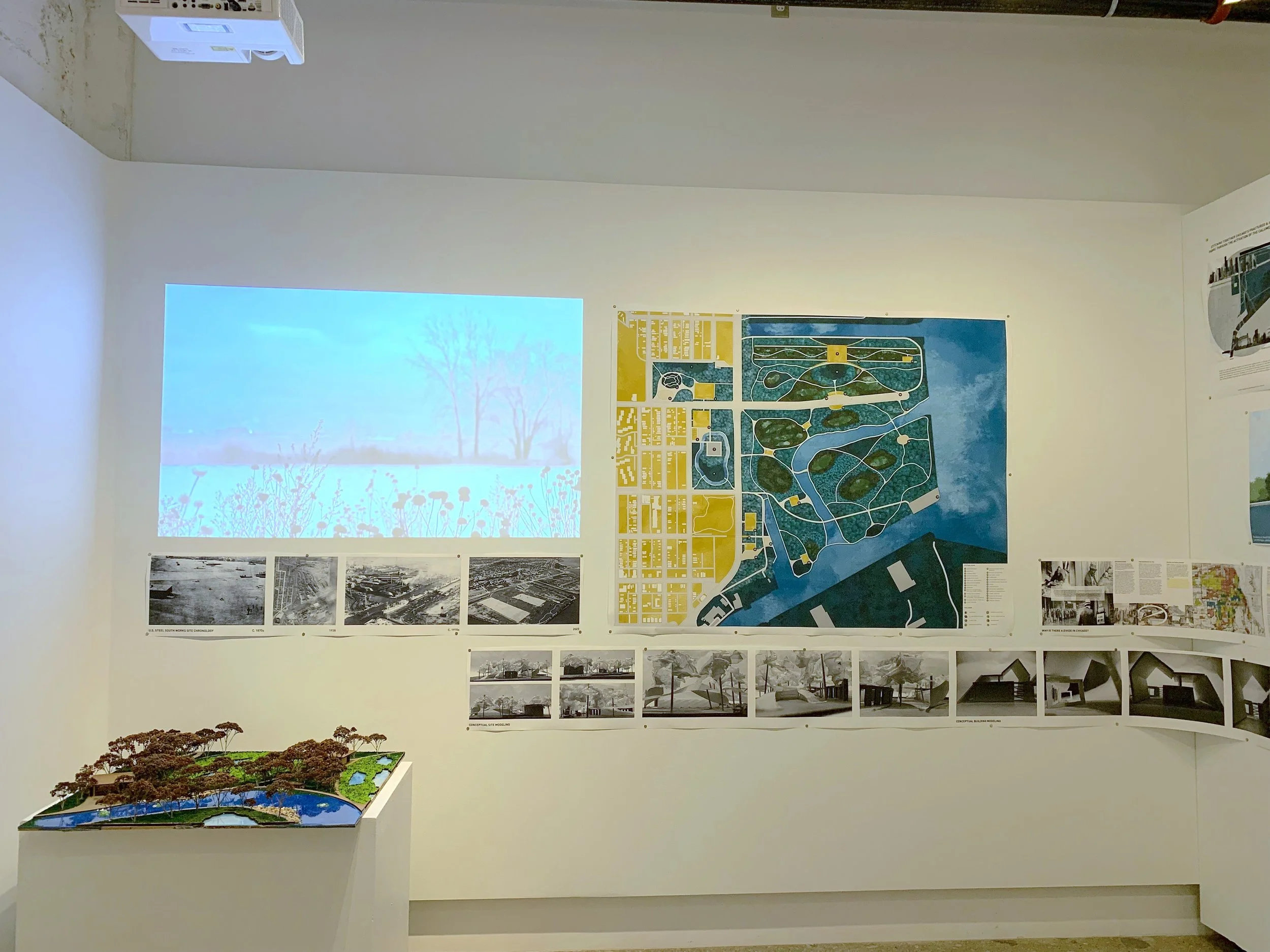
Bridging the equity gap between invested and disinvested neighborhoods in Chicago through the revival of vacant brownfields and greenfields along the Calumet River delta, connected to Lake Michigan. Stitching the surrounding neighborhoods by introducing lines of movement for learning, nodes of opportunity for local businesses, and landscapes of discovery. Providing a kit of parts for multi-functional spaces embedded in nature, allowing flexibility of expansion and contraction through modular architecture based on changing needs.
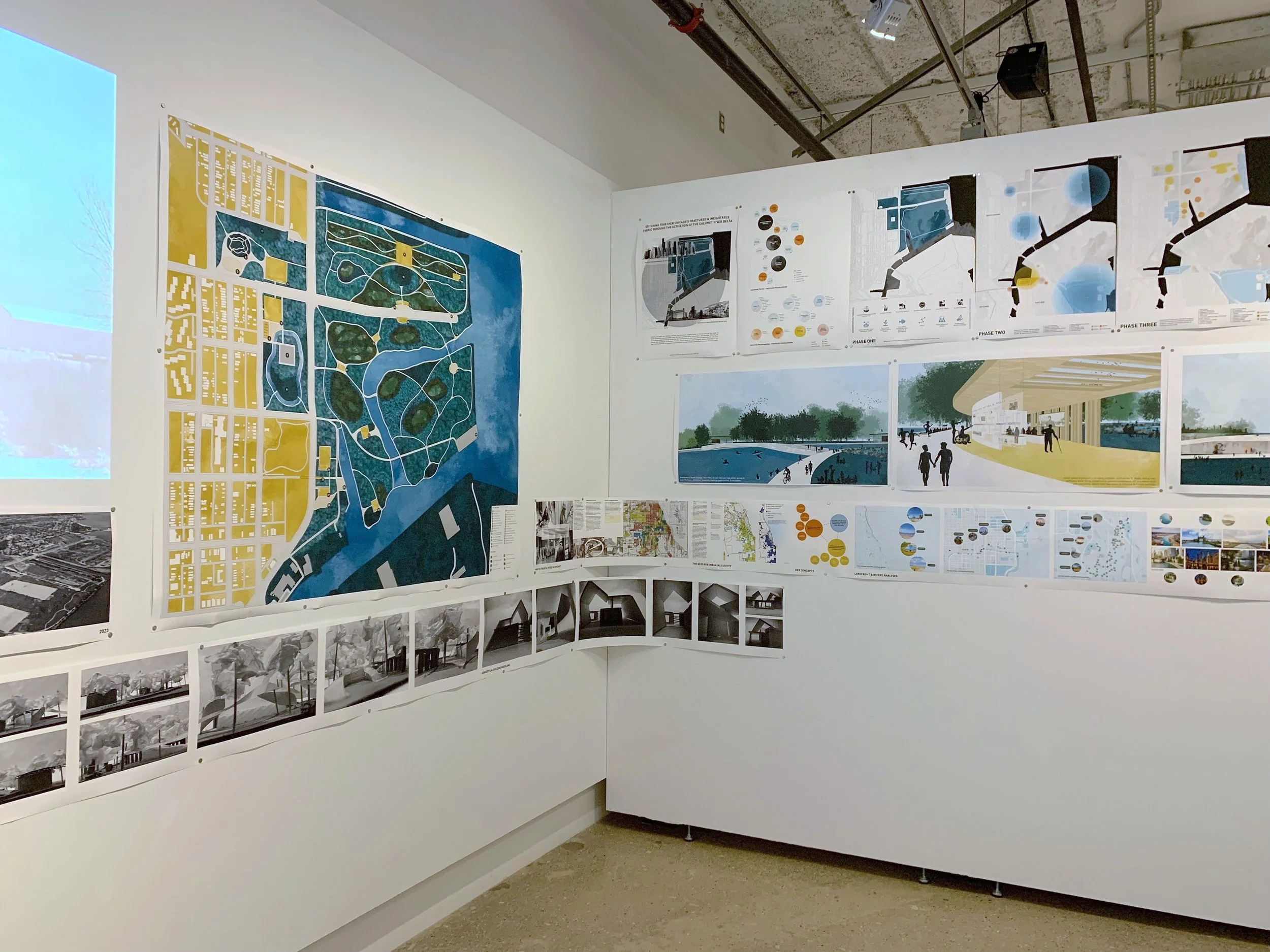
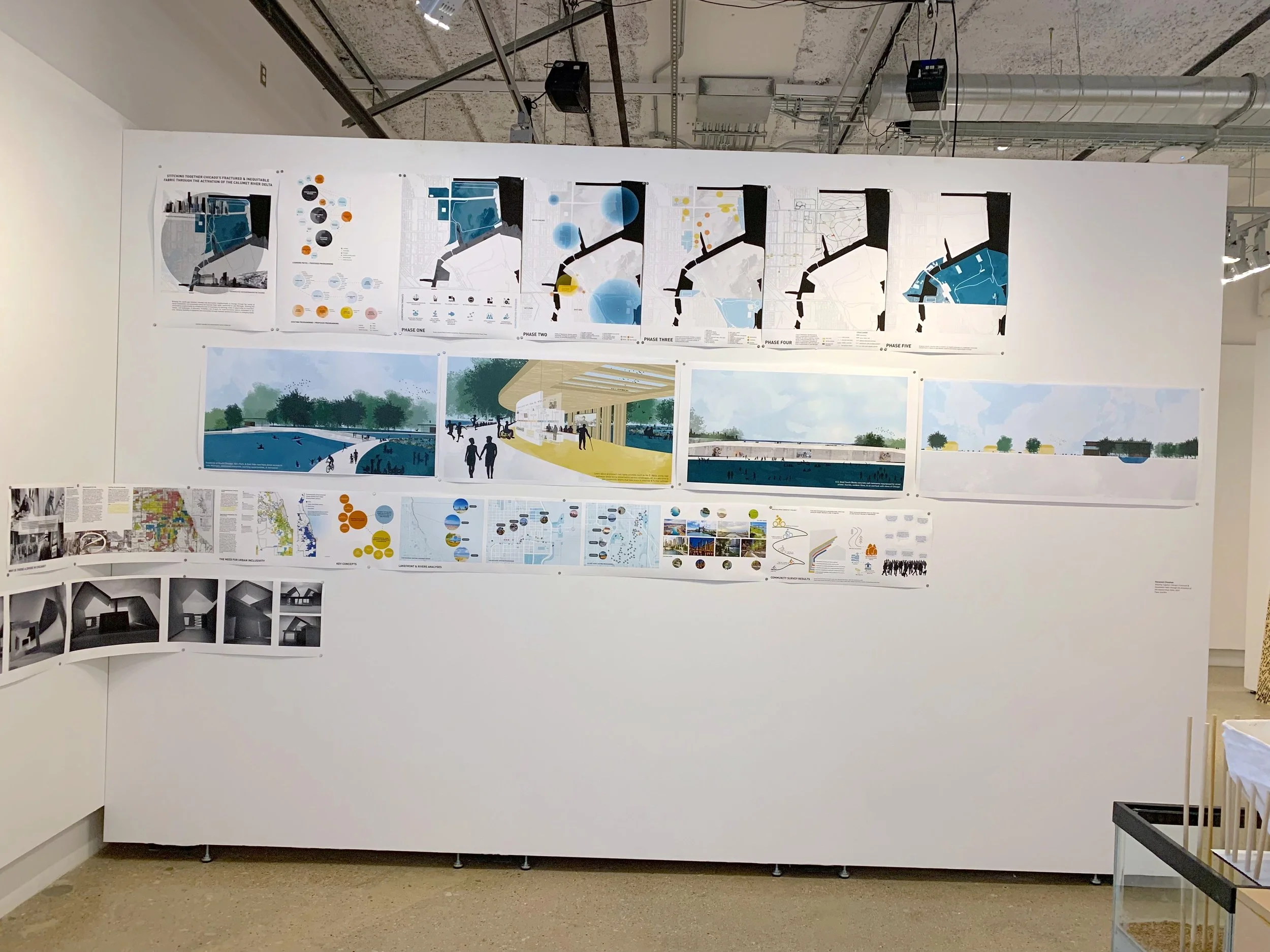
Stitching together Chicago’s fractured & inequitable fabric through the activation of the Calumet River Delta
Master of Architecture Thesis
The history of redlining and urban planning has created a divide among neighborhoods in Chicago. Efforts towards equity have not been significantly made and it is a political issue that should take priority. Disinvested areas suffer from a lack of resources, have poorer air quality, and are disconnected from economically developed areas. These concerns cause deeper-rooted problems within the quality of one’s life. How can we build equity and narrow the gap between these neighborhoods of Chicago?
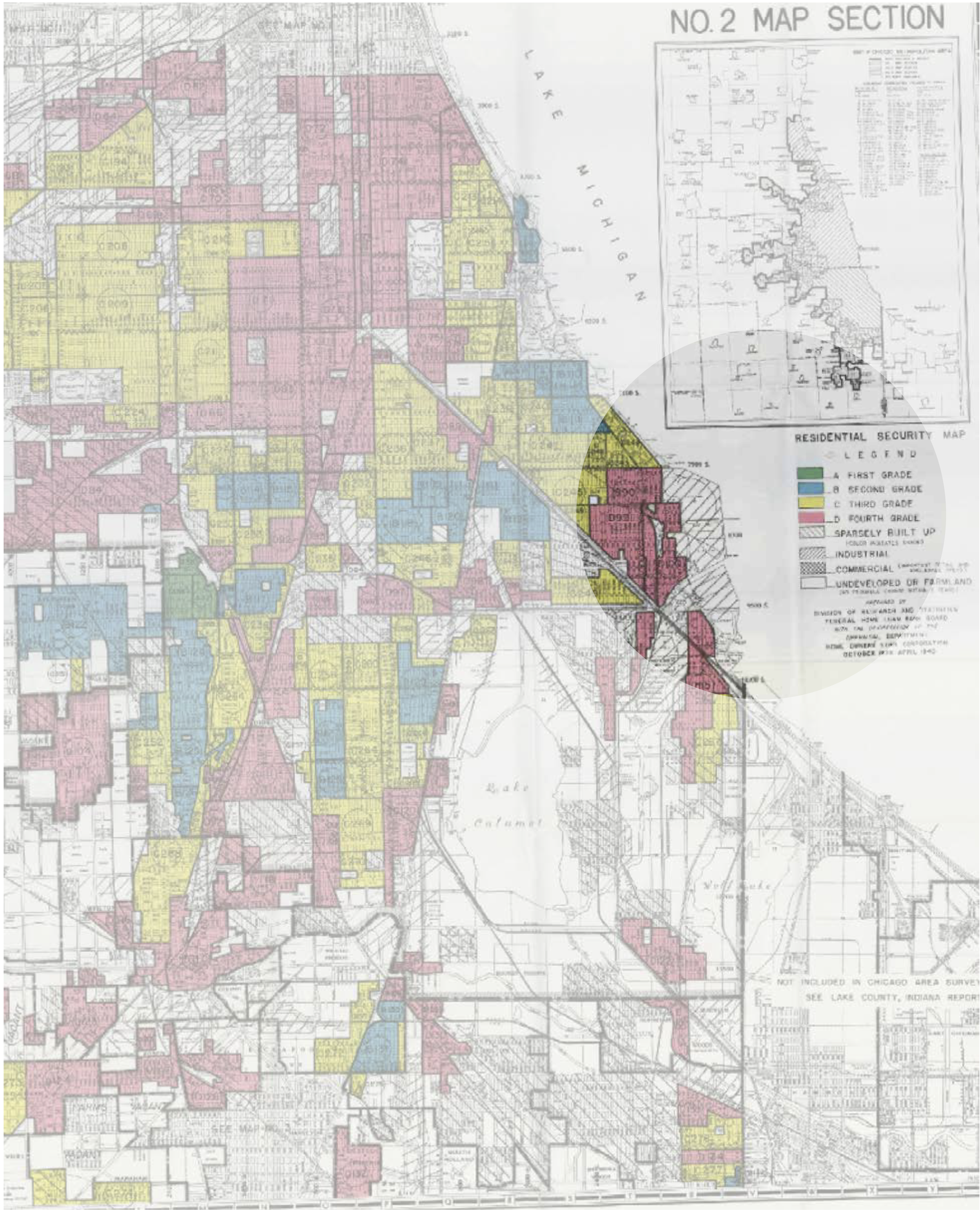
Redlining Map: Chicago 1935 - 1940
Redlining in Chicago
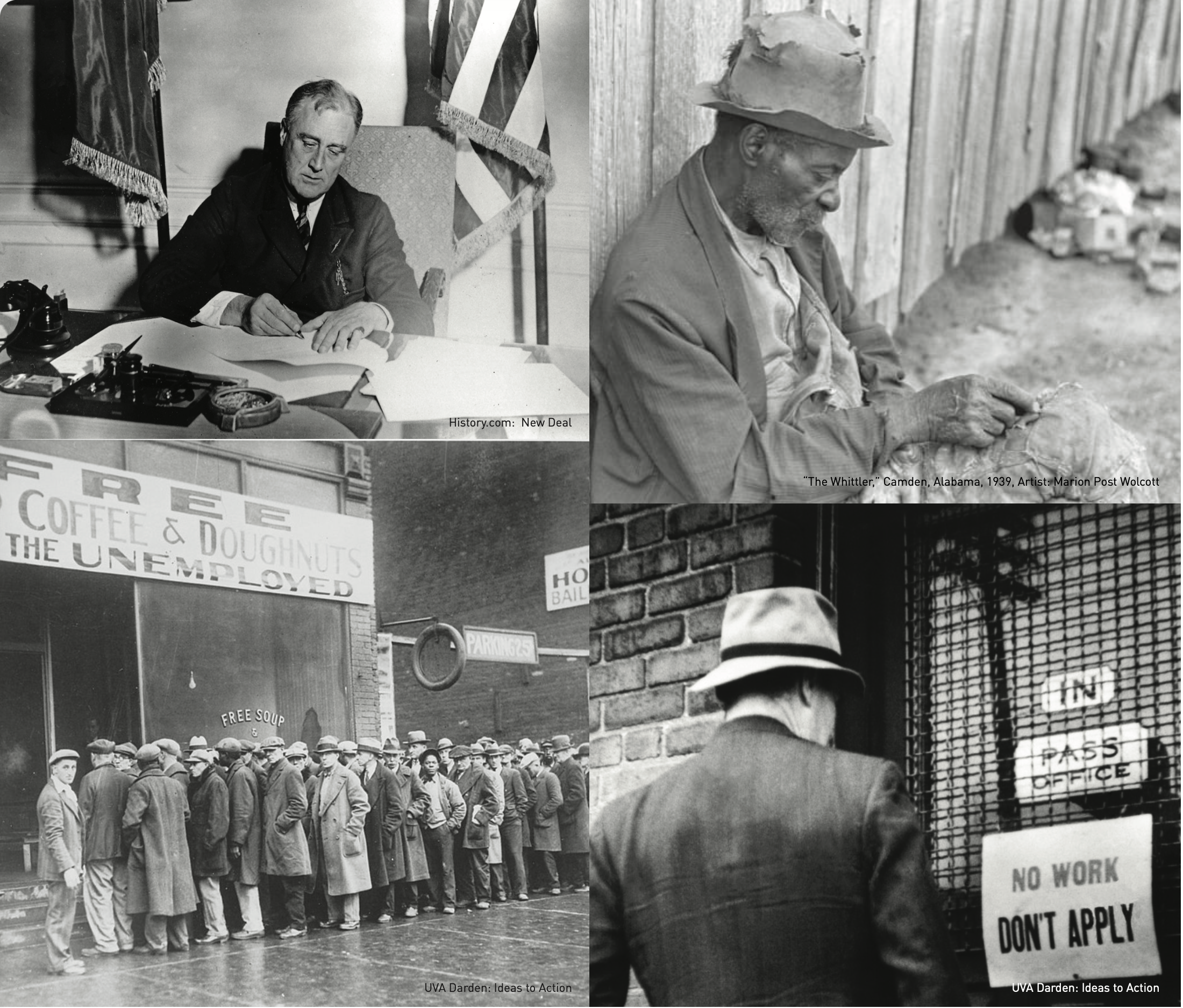
1930s: New Deal housing legislation signed by Franklin D. Roosevelt created separate neighborhoods for African Americans and Caucasians, maintaining the “social structure.”
Why haven’t these neighborhoods evolved into integrated metropolises? Federal government housing policies pushed for segregation, and this eventually led to redlining in public housing. Redlining is defined as a discriminatory practice in which services were withheld from potential customers who resided in neighborhoods classified as ‘hazardous’ to investment; these residents largely belonged to racial and ethnic minorities (“Redlining”). Maps were created in the 1930s by the Home Owner’s Loan Corporation (HOLC), where they defined areas of the city from “Best” colored in green, to “Still Desirable” in blue, “Definitely Declining” in yellow, and “Hazardous” in red.
Fair Housing Act of 1968
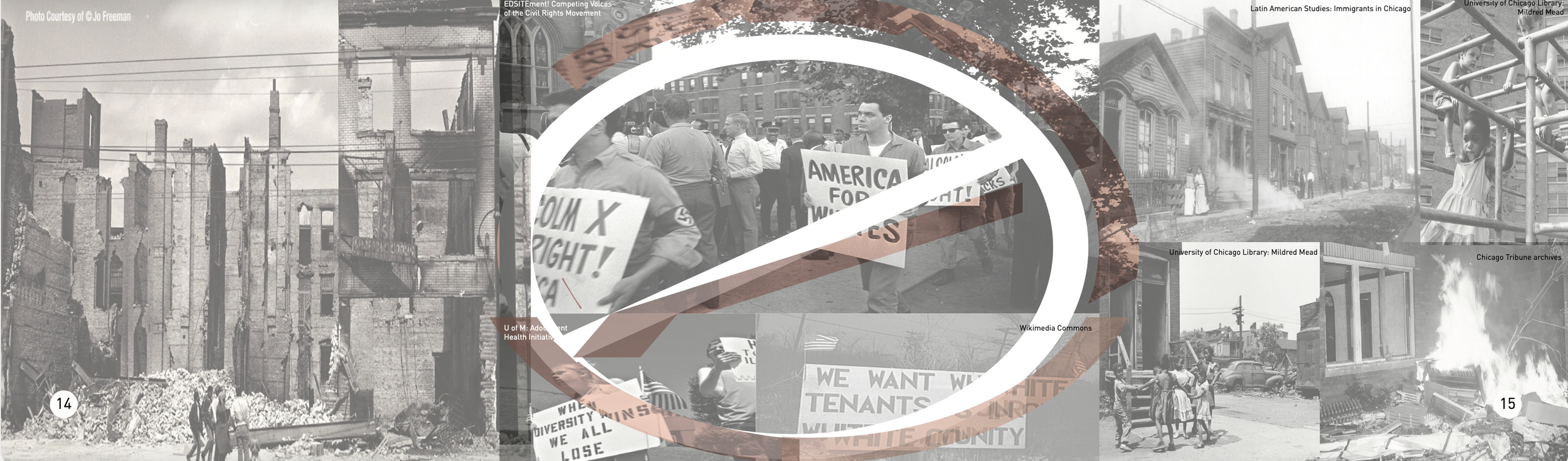
1940s: People of color were strategically placed in neighborhoods seeing wear and tear from the previous white residents. Due to the absence of job security given to the new settlers, they had no choice but to settle in the “definitely declining” and “hazardous” areas, with little options for repairs. Generations of residents in these areas have been cornered into cycles of poverty due to the pre-existing structure of racial inequality.
1968: FHA prohibited discrimination concerning the sale, rental, and financing of housing based on race, religion, national origin, or sex (History.com Editors). Although the Act outlawed redlining, these issues are still very present and continue to negatively impact minority groups today. The city invested in “hazardous” areas by building schools, churches, and recreational centers, but only to keep minority groups from expanding into predominately “white” areas.
The fall of South Chicago
1970s: People of color who desired to live in better neighborhoods were driven out by violence from white residents who wanted to keep the areas divided. No matter where they went, the racial structure followed them. This ultimately led to the deterioration and vacancy of buildings and homes, plummeting the population, causing crime rates to rise.
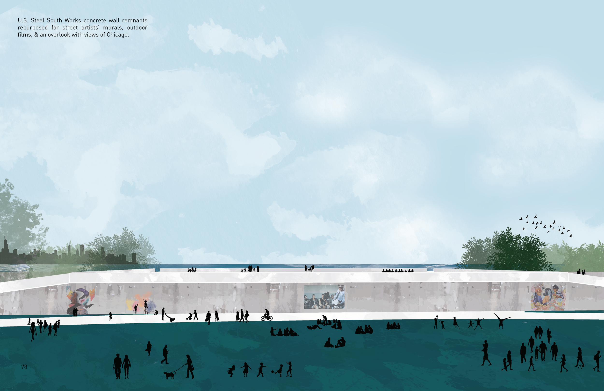
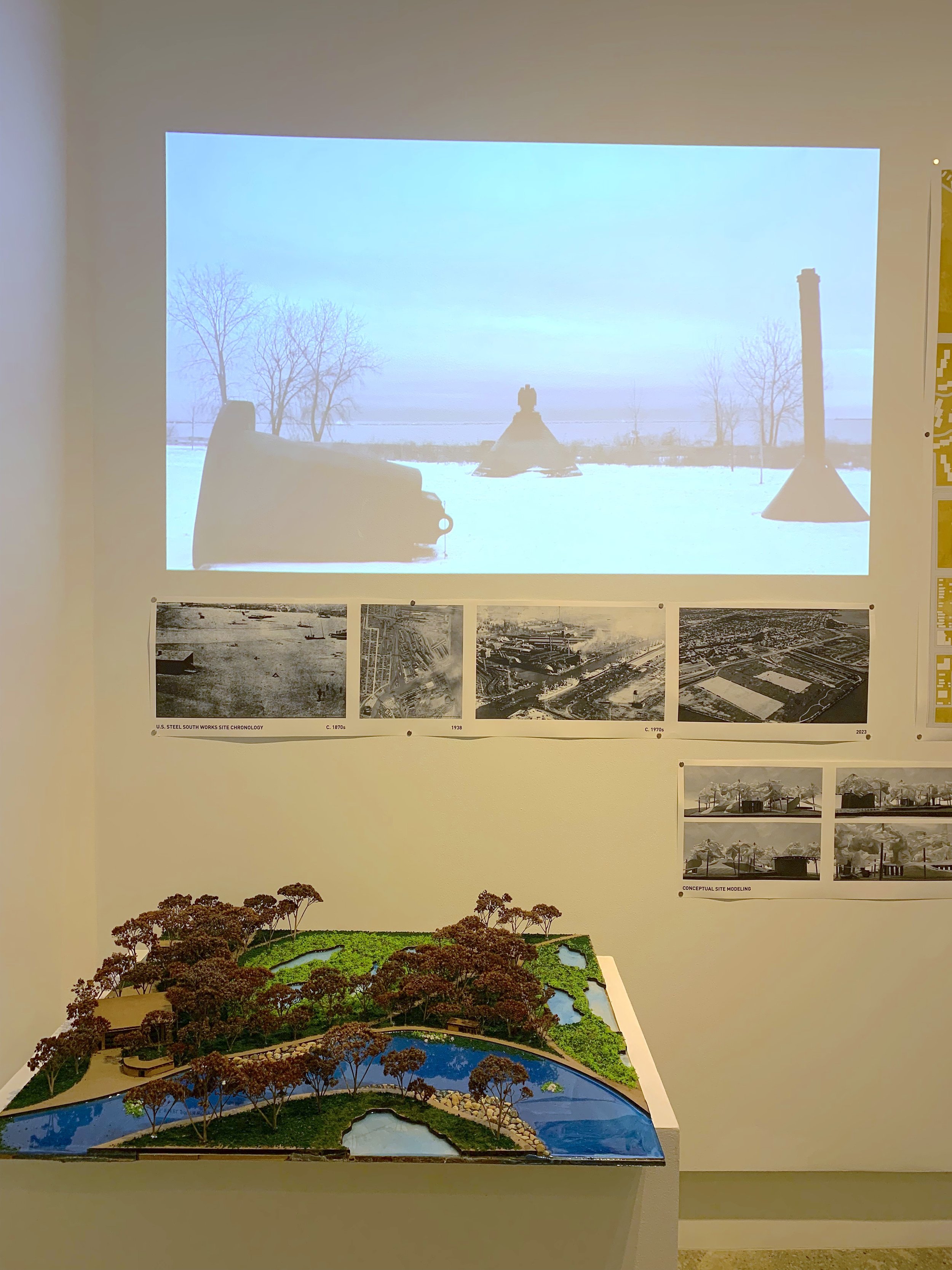
1992: U.S. Steel South Works, a steel manufacturing plant, began downsizing in the ‘70s, and ultimately closed its facilities in 1992 (Kaplan, Jacob). White flight increased as the South Chicago fell into economic despair and the area hasn’t been able to fully recover since.
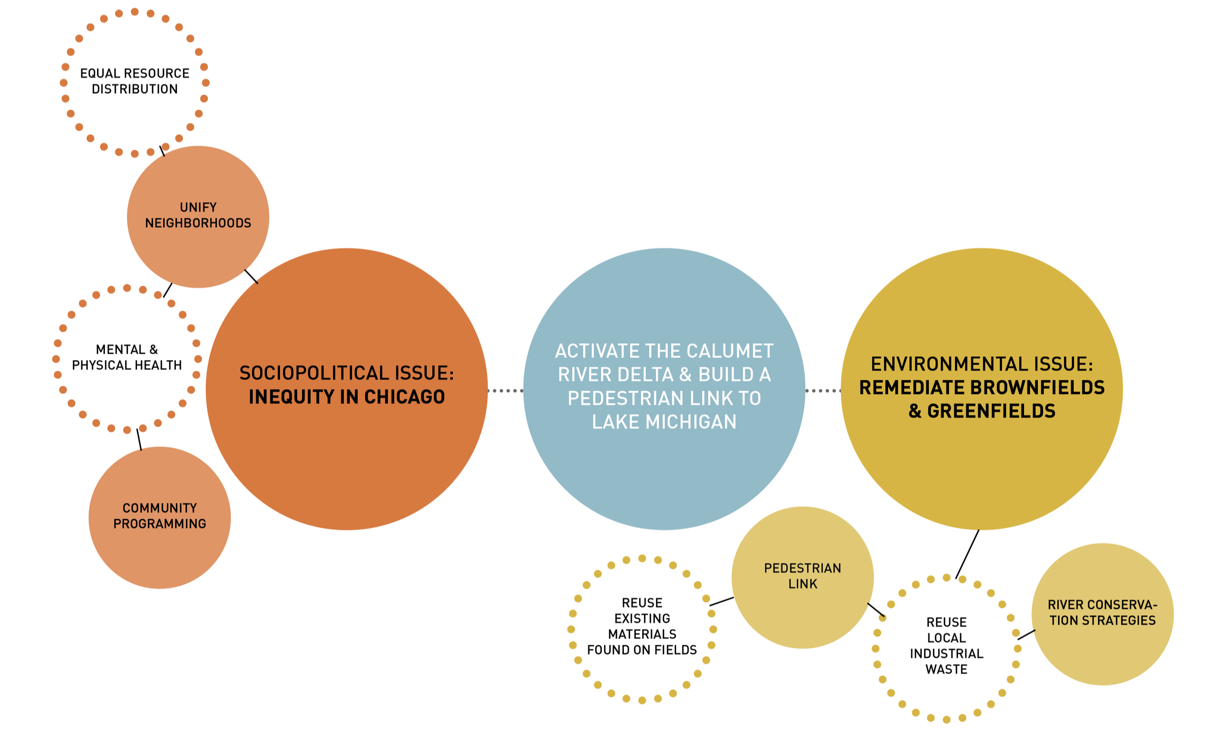
Architectural Concern: Urban Exclusion
Specific neighborhoods being significantly left out of the economic progress of the city has created a divide among the residents. Some have access to more opportunities, better education, employment, cleaner parks / recreation, security, public spaces and services, transportation, and resources, while others have been left out. Historically disinvested neighborhoods are worthy of access to equal resources and healthy environments.
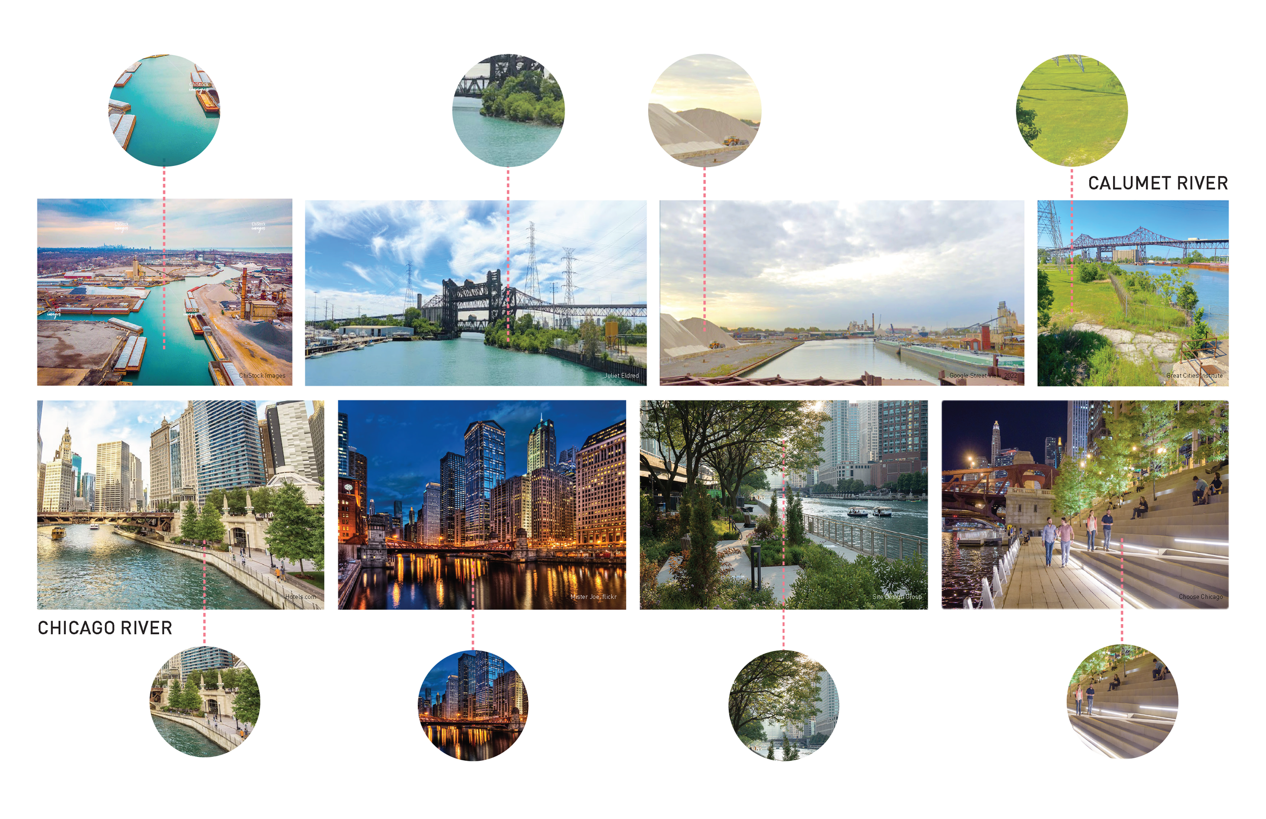
Opportunity for Remediation: The Calumet River
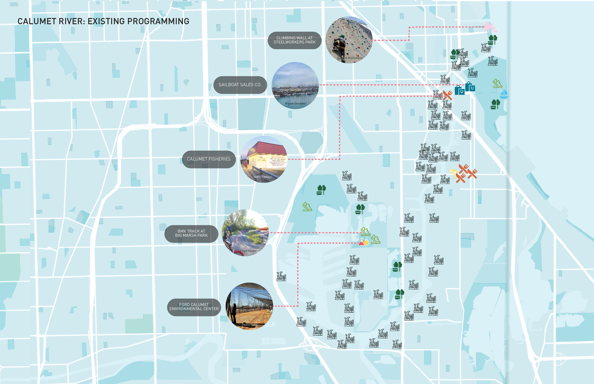
The Calumet River’s ecology has been damaged and the landscape has been fragmented from the industrial development in the 1800s. Restoring the land and water will not only be beneficial to the surrounding ecosystems but can also enhance the physical and mental well-being of the people around it through better air quality and community programming.
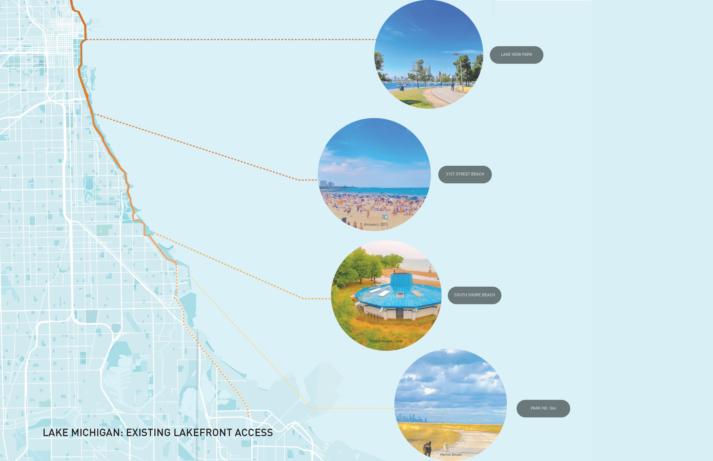
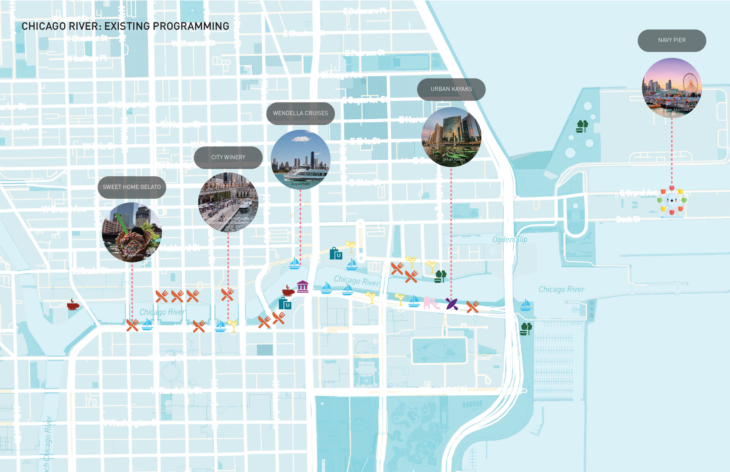
Community programming can be activated along the river from vacant brownfields and greenfields. The mouth of the river leads into Lake Michigan, providing the opportunity to build lakefront access and pedestrian connectivity where it is currently missing. Regenerating the fields present many opportunities for gathering, retreat, learning, growing, socializing, resting, moving, etc. Community surveys from the immediate surrounding neighborhoods will determine the use of the lots.
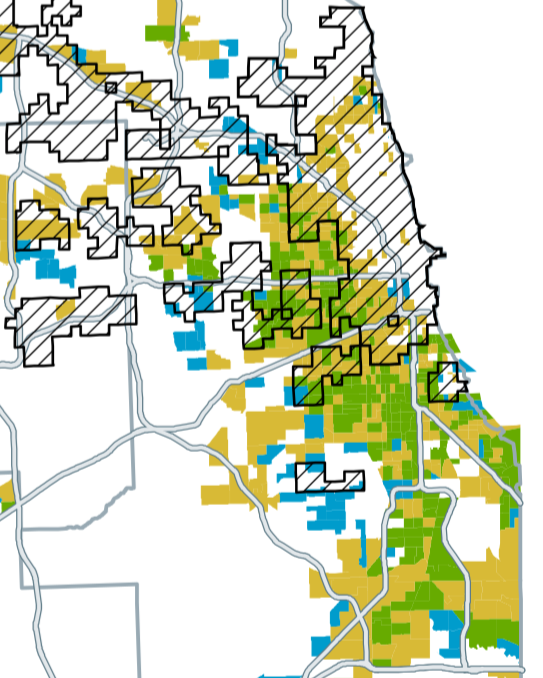
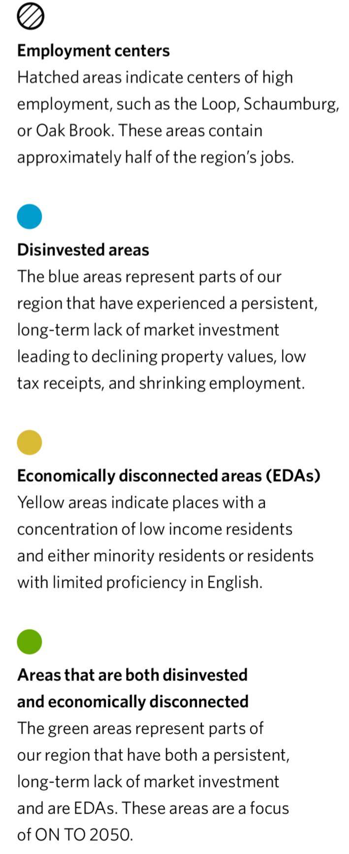
Economically Disconnected Areas (EDAs), 2013. Source: Chicago Metropolitan Agency of Planning
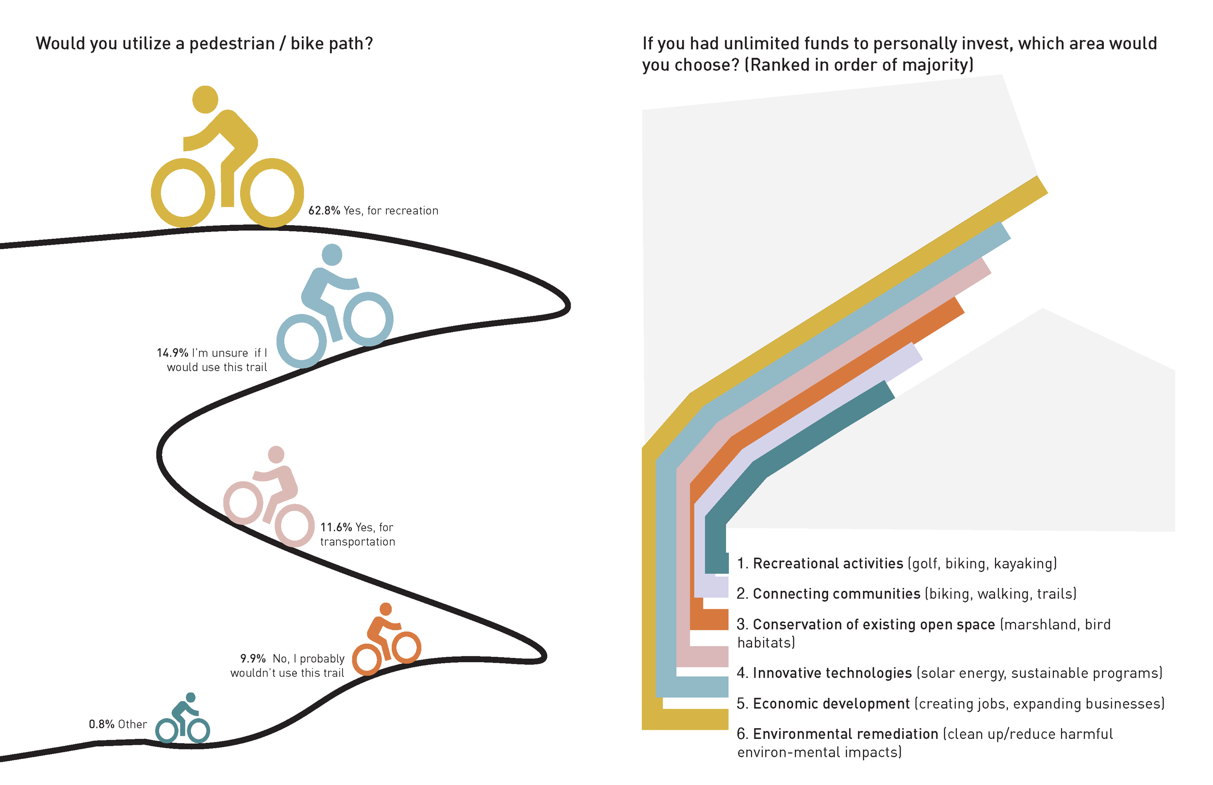
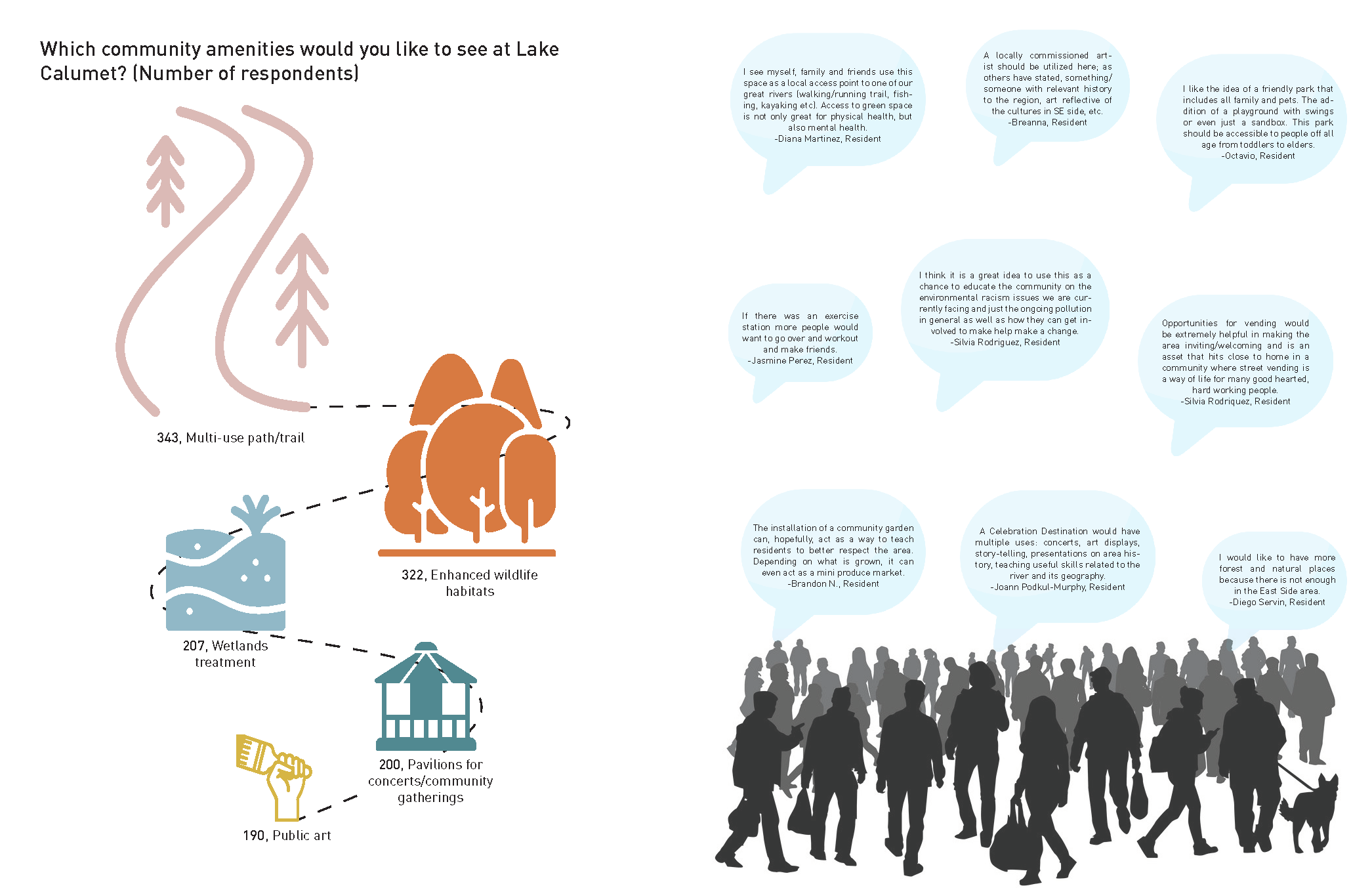
Community Survey Results
Sources: Illinois International Port District Master Plan, 100th Street River Access - Great Cities Institute (UIC), CMAP
Neighborhoods Surveyed: South Chicago, East Side, Vet’s Park, South Deering, Hedgewisch, Calumet Heights, Pullman, Dolton, Roseland, West Pullman, Burnham, Riverdale/Altgeld Gardens, Other
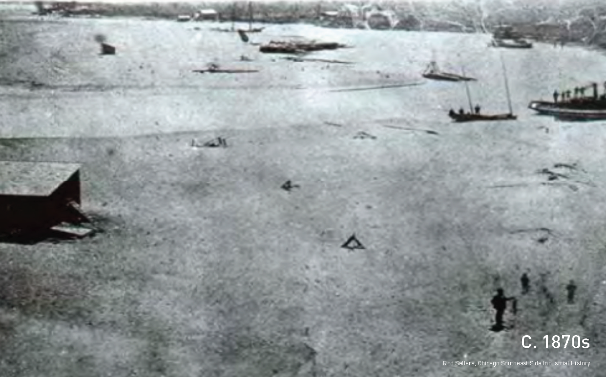
Site Chronology
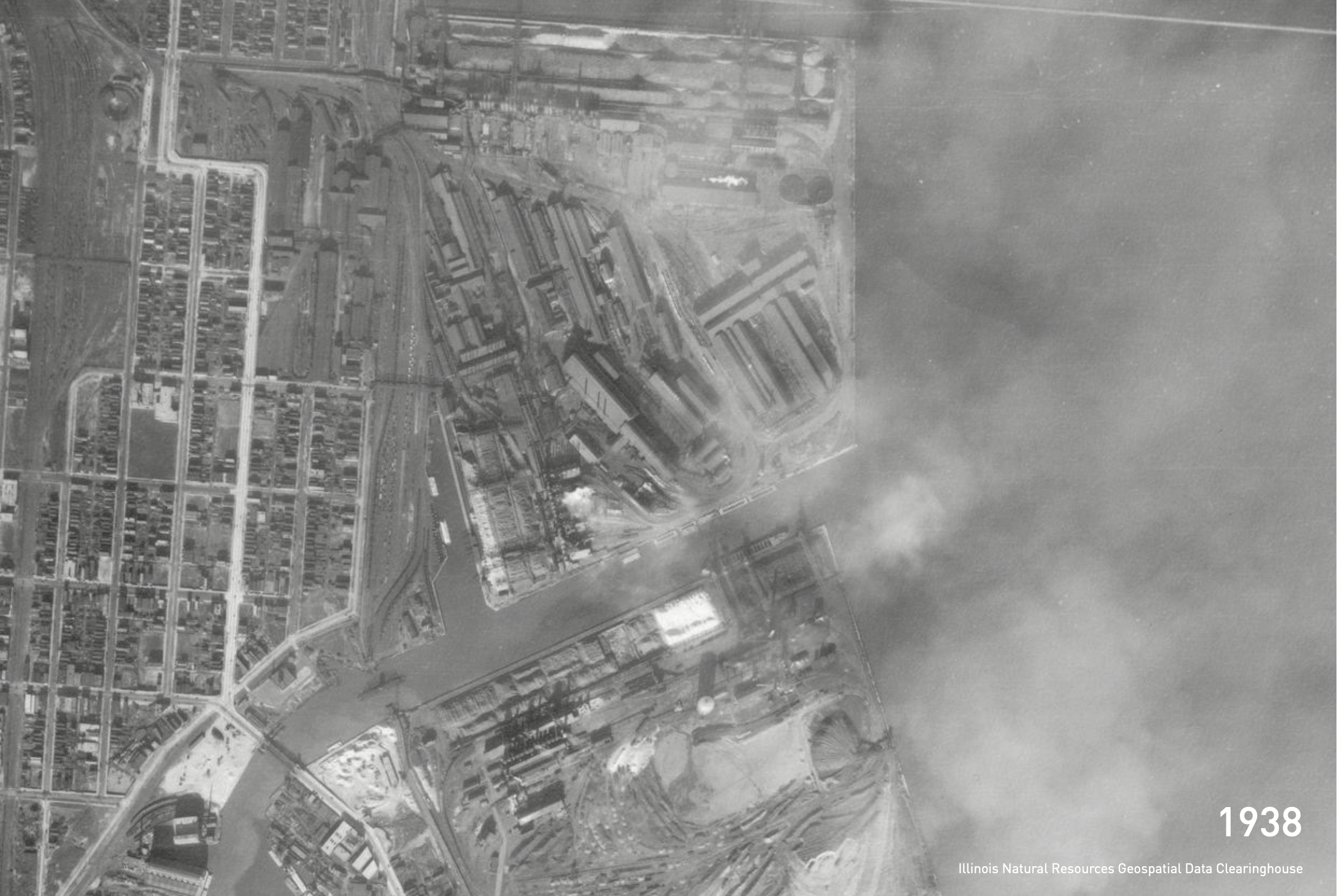
Site Chronology
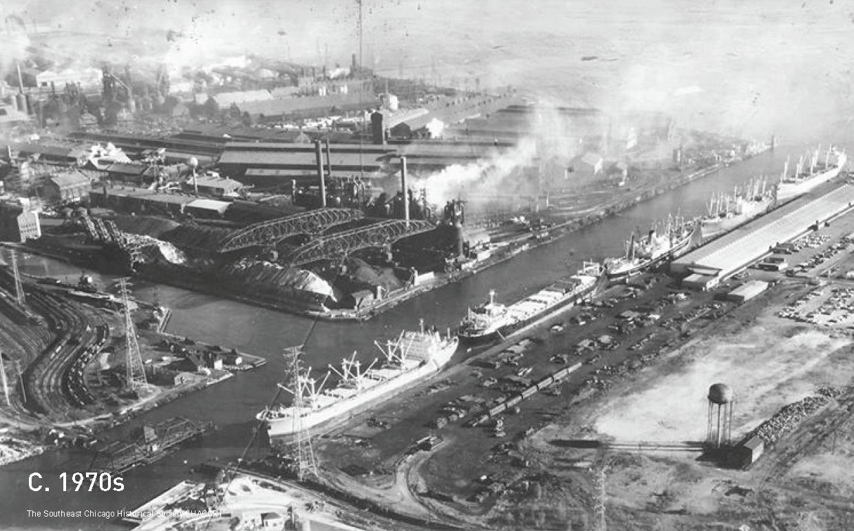
Site Chronology
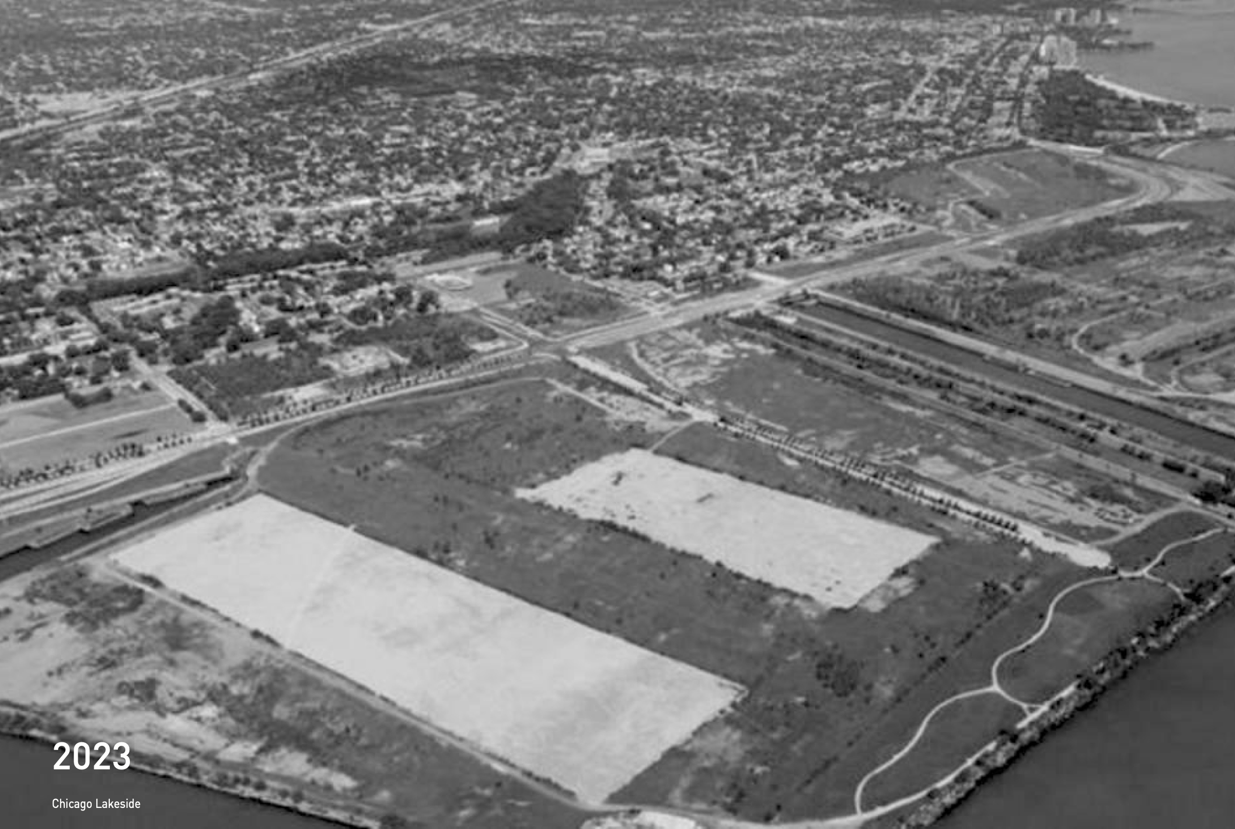
Site Chronology
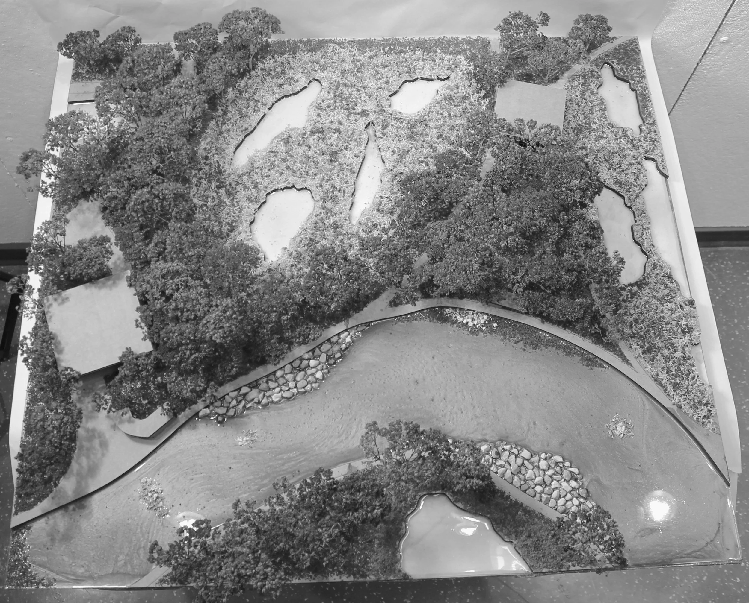
Site model photography

Site model photography

Site model photography
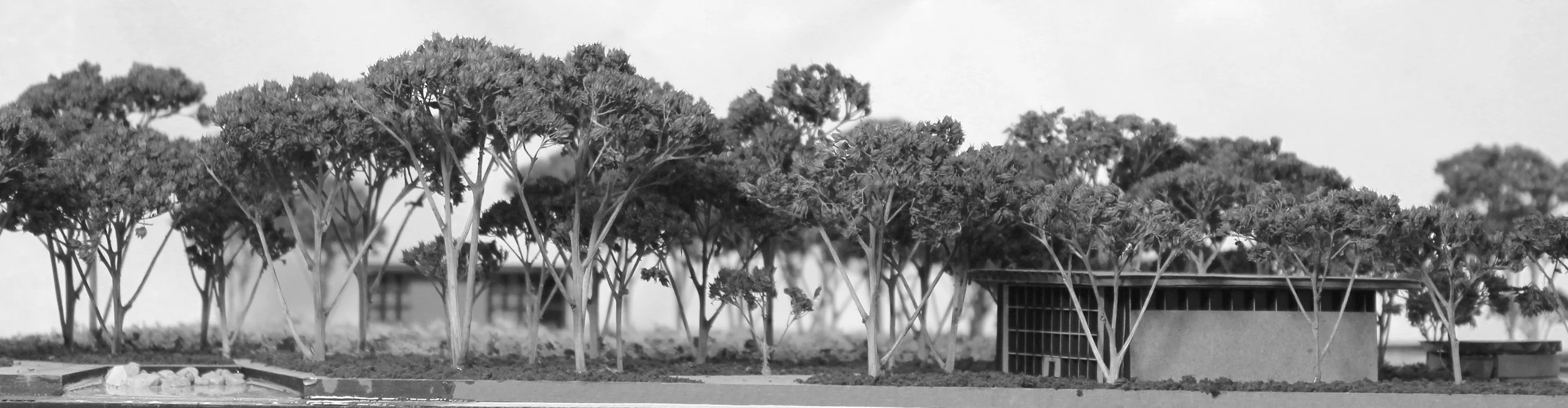
Site model photography

Site model photography

Site model photography
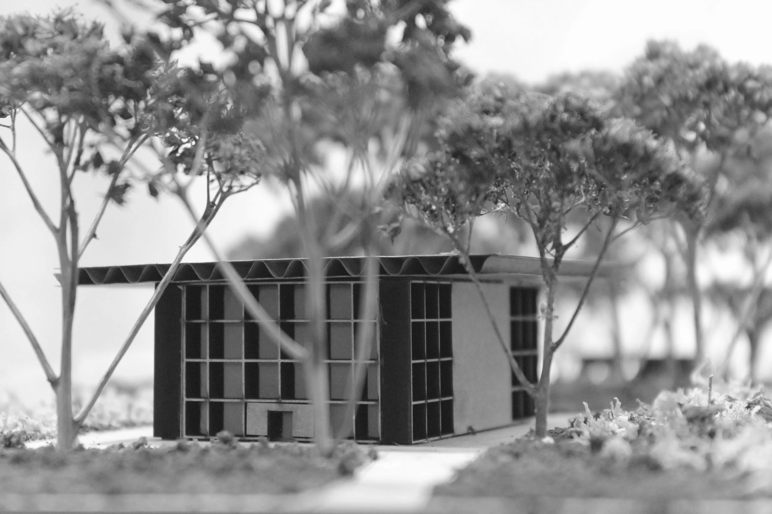
Site model photography

Site model photography
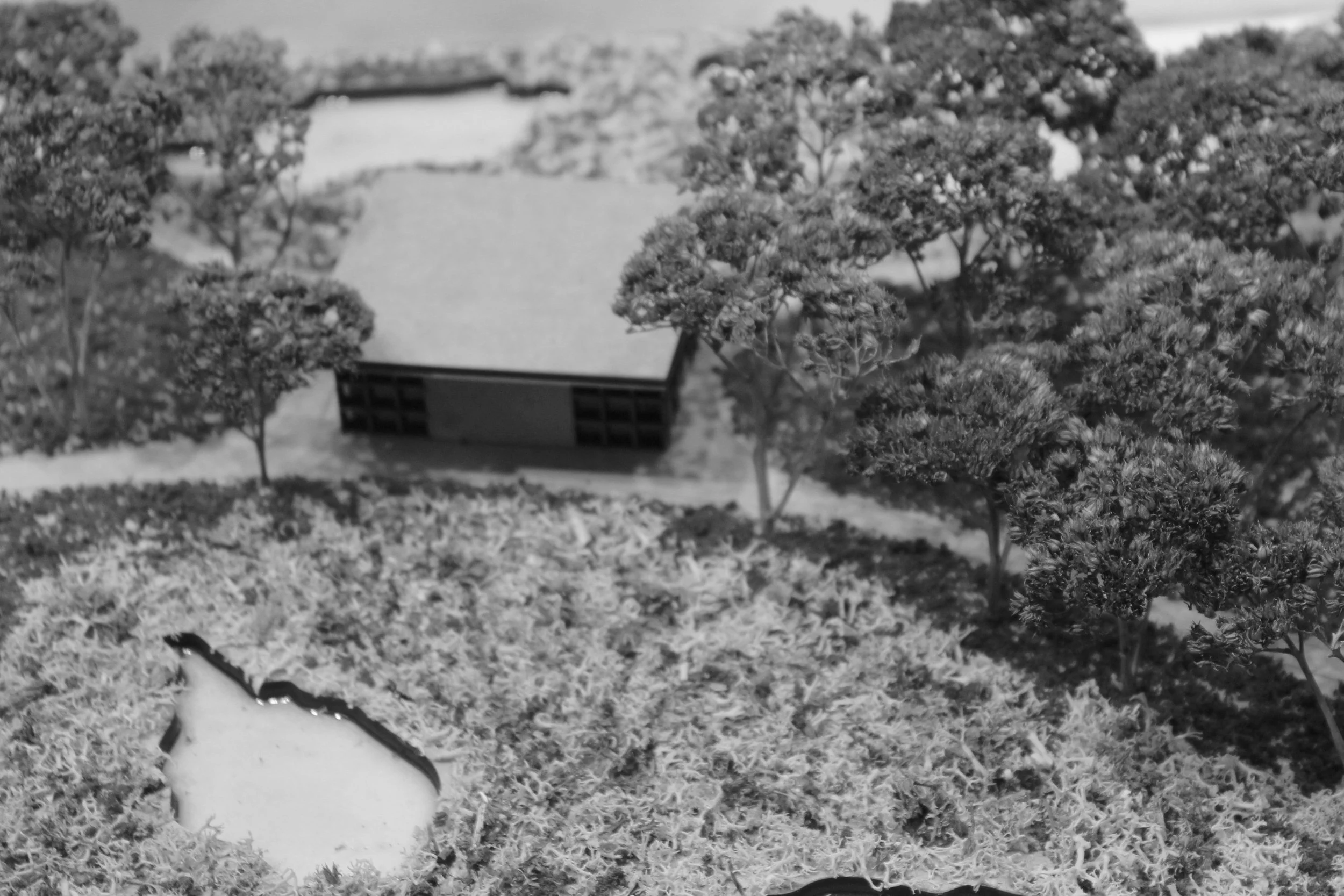
Site model photography
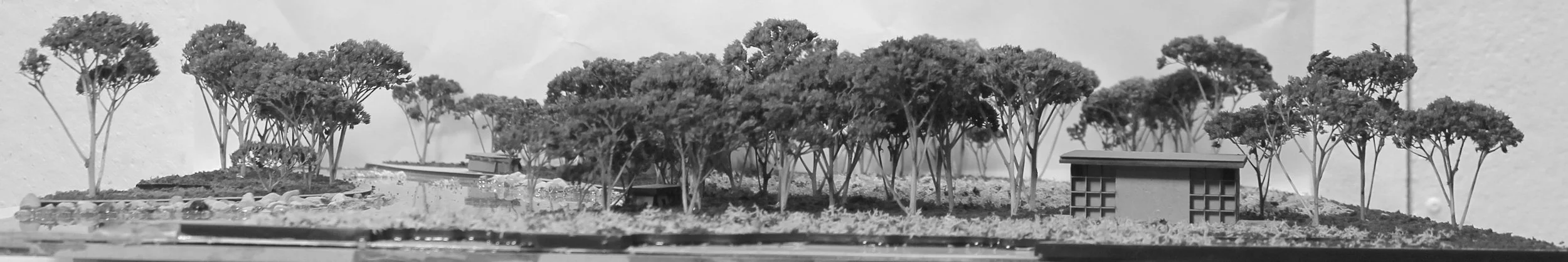
Site model photography
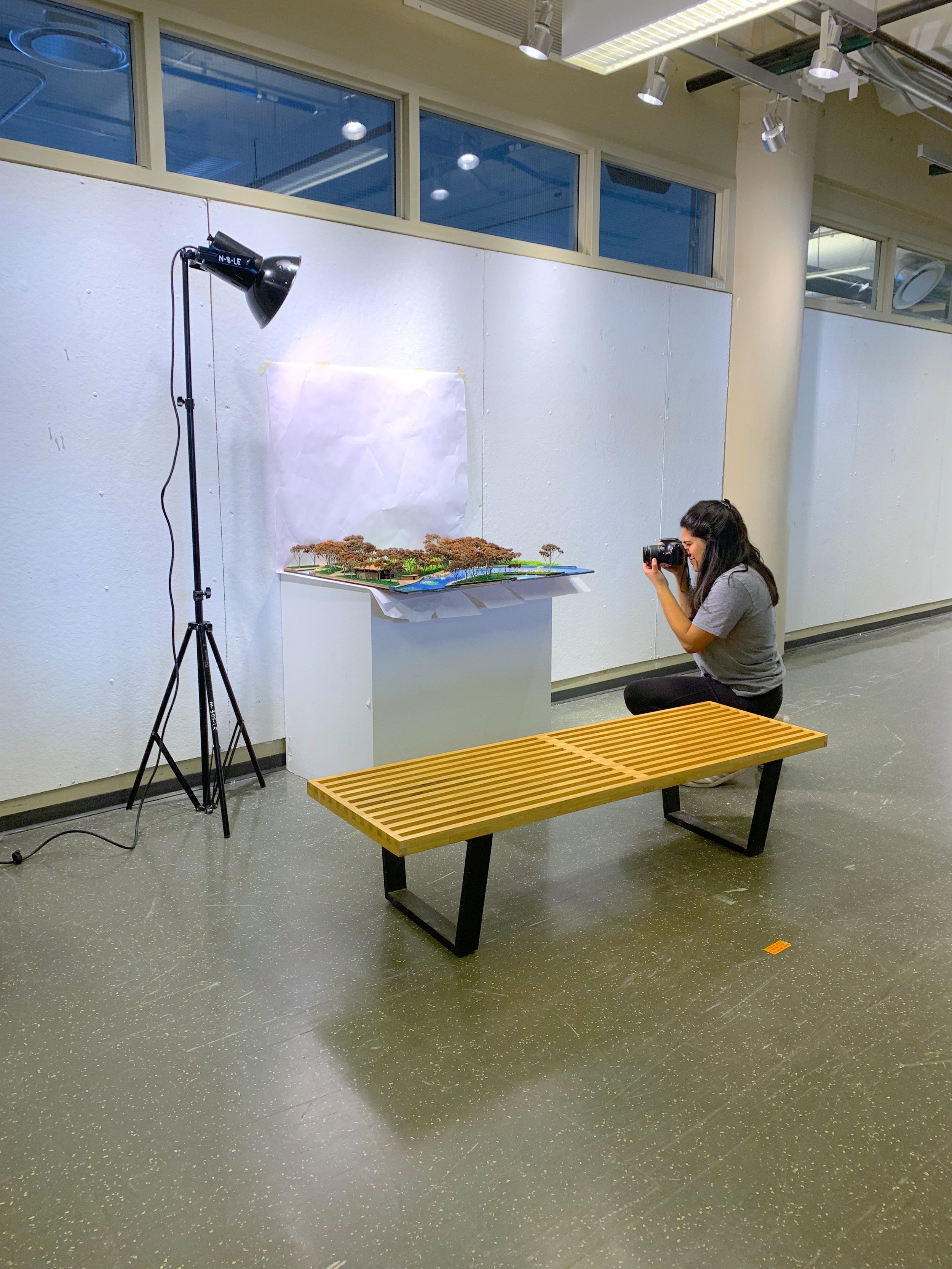
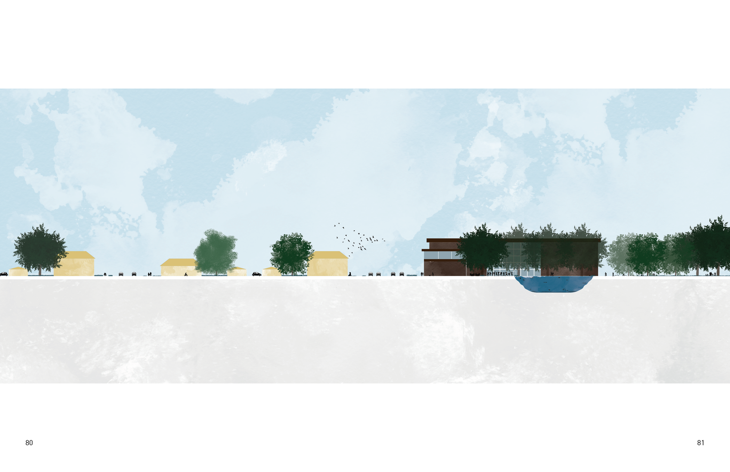
The following pages document work exhibited in The School of the Art Institute’s Graduate Show II Thesis Exhibition.
The following pages document work exhibited in The School of the Art Institute’s Graduate Show II Thesis Exhibition.
The following pages document work exhibited in The School of the Art Institute’s Graduate Show II Thesis Exhibition.
The following pages document work exhibited in The School of the Art Institute’s Graduate Show II Thesis Exhibition.
The following pages document work exhibited in The School of the Art Institute’s Graduate Show II Thesis Exhibition.
Bibliography
Chicago.gov. “Chicago Top-10 Trees.” Increasing Tree Diversity in Chicago’s Landscape. Accessed April 6, 2023. https://www.chicago.gov/content/dam/city/depts/streets/supp_info/Forestry/2012TreeoftheYear8x11Brochure.pdf.
Córdova, Teresa. “100th Street River Access Concept Plan.” Great Cities, Great Rivers, February 2022. https://greatcities.uic.edu/wp-content/uploads/2022/04/100thStreetConceptPlan-418-1.pdf.
History.com Editors. “Fair Housing Act.” History.com. A&E Television Networks, January 28, 2021. https://www.history.com/topics/black-history/fair-housing-act.
“Invest in Disinvested Areas.” CMAP. Accessed January 29, 2023. https://www.cmap.illinois.gov/2050/community/disinvested-areas.
Kaplan, Jacob. “South Works.” Forgotten Chicago, December 8, 2008. http://forgottenchicago.com/articles/south-works/.
Leahy, Maggie, Alex Essig, and Eric Shea. “Redlining in South Side Chicago.” ArcGIS StoryMaps, November 2020. https://storymaps.arcgis.com/stories/6013968f316041879011fdc03857e146.
Openlands. “Little Calumet River Conservation Action Plan.” Openlands, March 31, 2021. https://openlands.org/wpcontent/uploads/2021/06/CLCP-CAP-Final_21.03.31-spreads-reduced.pdf.
“Port Master Plan Survey.” Illinois International Port District Master Plan, February 21, 2021. https://ehq-production-us-california.s3.us-west1.amazonaws.com/ab873835ae41f24cc0b7df018d09a61b8e05d3d4/original/1614368706/IIPD-survey-report-web.pdf_58fd6f0aaf0a2e65f478f7a86a077981?X-Amz-Algorithm=AWS4-HMAC-SHA256&X-Amz-Credential=AKIA4KKNQAKICO37GBEP%2F20230518%2Fus-west-1%2Fs3%2Faws4_request&X-Amz-Date=20230518T075854Z&X-Amz-Expires=300&X-Amz-SignedHeaders=host&X-Amz-Signature=1d2b9199c32e1c493a9e66b836edcb2751bf2e532e68f010d97bdaabe406a10e.
“Redlining.” Wikipedia. Wikimedia Foundation, December 15, 2021. https://en.wikipedia.org/wiki/Redlining.
“Travel Patterns in Economically Disconnected Area Clusters.” CMAP, January 24, 2018. https://www.cmap.illinois.gov/updates/all/-/asset_publisher/UIMfSLnFfMB6/content/travel-patterns-in-economically-disconnected-area-clusters.